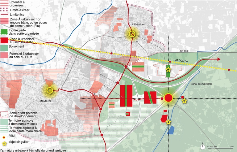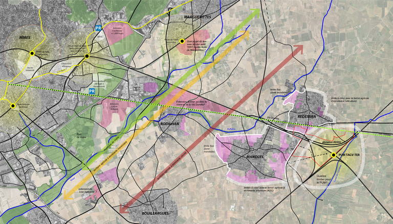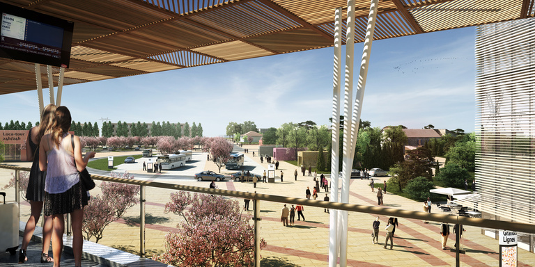
The arrival of the high-speed rail station introduces an essential intermodal hub by creating a centre for a rail network associating a TGV (high-speed rail) line with the existing network. This new centre will come into being in a territory that has been inhabited for 2,000 years, with the lovely old villages of Manduel and Redessan associated with an agricultural landscape.
The question then becomes that of understanding who will occupy this project, starting with the principle that contrasting “families” will be sharing the same space at the same time while living within different time frames.
These families have been identified as follows: Three are current occupants of the site: the “village identity”, the agricultural world and the “residential path”; one is the reason for the project itself: the traveller. Three others are brought about by urban developments: tertiary activity, the agri-park based on the development of proximity agriculture and the Agglo Parc, which introduces the event dimension
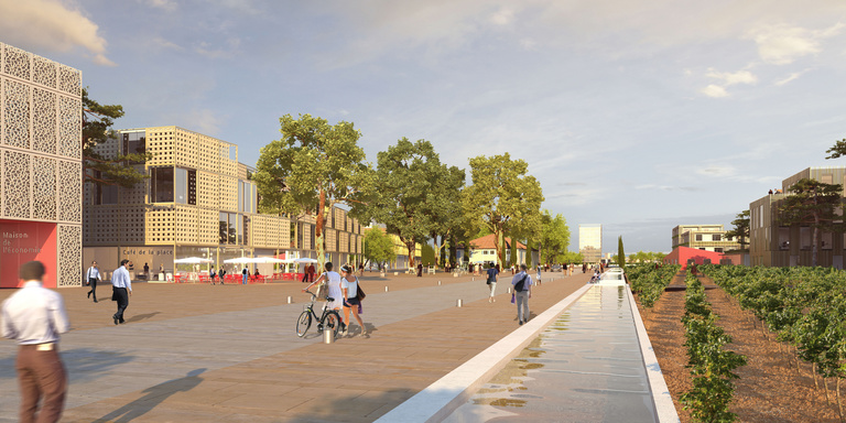
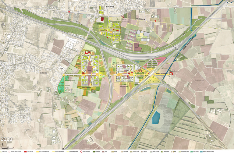
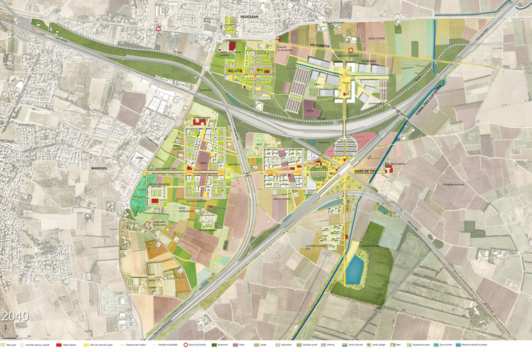
On these bases, we want to build an “inhabited environment” that partakes of the current symbolism of the place. We imagine “minimum” routes by superimposing a cardo decumanus on the site, with the axis on the core of the rail network. Then, quadrant by quadrant, we locate urban functions defined by their critical mass and their complementarity, but also by a reasoned balance between the filled and the void, built-up areas and agriculture.
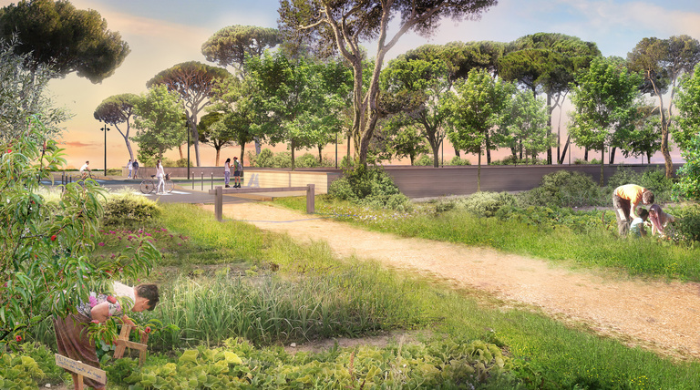
We want define a “commons” that can serve as the link in time and space, between projects and between people. For us that is the role of the “landscape”.
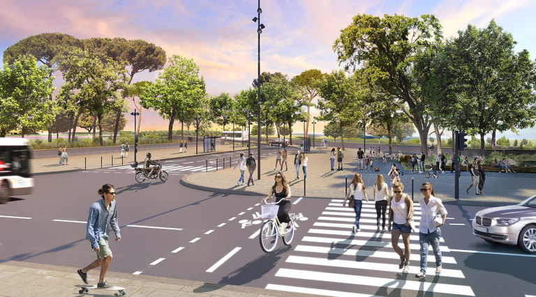
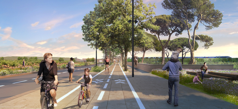
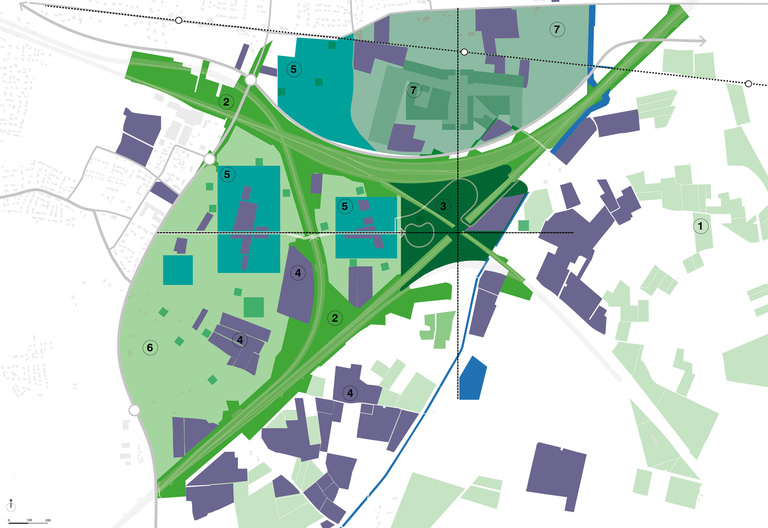
Seven landscapes are involved in this transformation: Agricultural landscapes; mobility landscapes; the welcome garden at the station; the symbolism of the vineyard, which will remain the identity reference linking all the landscapes; the inhabited park, which will contain and organise the new residential and tertiary functions; the agri-park, which will be the place of transformation of agricultural practices through “proximity” with the city; the Agglo-Parc, designed on a metropolitan scale to accommodate event functions
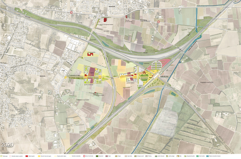
The project will be built over a period of 20 years – the space of a generation. To respond to that difficulty, we imagine a project that is open and subdivided based on a limited number of constants which are then superimposed on the modes of development and implementation suited to each scale and each architectural programme.
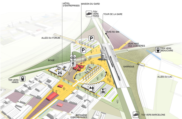
Only the station and causeway that mark the decumanus are necessary for opening the site. The platforms mixing habitat and work will be organised along that axis. The north-south axis of the cardo will later house the event functions (the Agglo Parc) and tourism locations. The Agri Parc and the functions integrated into it (the Agricultural Hamlet and the Third Millennium Mas) will evolve at its own pace within a larger territory.
The subdivision of spaces and purposes of the project is also an operational tool for good project economics and good time management. Developing 320,000 m² on some forty hectares is a prudent and controllable scale. It cannot predict the nature and impact of a global project developed on 250 hectares.
Delivery :
2025
Urban-development project supervision for creation of the Nîmes Métropole LGV Multimodal Transport Hub
Urban planning and production of a Master Plan
Project Owner
CA Nîmes Métropole
Project Supervision
Reichen et Robert & Associés, agent
Landscaping: Atelier Jacqueline Osty & Associés
Technical Design Office: Arcadis
Economics and urban planning and specification: Alphaville
Mobility Technical Design Office: Roland Ribi & Associés
Technical Design Office, HQE: Oasiis
Area
Perimeter of broader territory (7 landscapes): 250 ha
Operational perimeter: 90 ha
Total floor area: 300,000 m²
Offices: 115,000 m² floor area
Craft & industry (SMEs): 115,000 m² floor area
Facilities: 53,000 m² floor area
Hotels: 16,500 m² floor area
Perspectives
DA+
